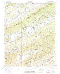
1938 Map of Mendota
USGS Topo · Published 1970About this map
Mendota sits at the base of Clinch Mountain, where the North Fork Holston River bends sharply through Poor Valley. This 1938 survey, updated with 1968 aerial data, highlights a rural economy dependent on river crossings and small-scale industry like Barker Mill. Numerous fords, including Hobbs Ford and Stacher Ford, along with the Southern railroad line, demonstrate how local transportation navigated the ridges and water gaps of the Appalachian landscape.
Find a feature on this map
79 named features on this map. Tap any name to fly to it.
Don’t see what you’re looking for? This feature index may not catch every label — zoom into the map to look around manually.
Map Details
Editions of this 1938 Mendota Map
4 editions found
Other maps of this area

1897 · Bristol
USGS Topo · 1:125,000

1902 · Bristol
USGS Topo · 1:125,000

1918 · Carterton
USGS Topo · 1:62,500

1920 · Coeburn
USGS Topo · 1:48,000

1934 · Wallace
USGS Topo · 1:24,000

1934 · Hansonville
USGS Topo · 1:24,000

1934 · Bristol
USGS Topo · 1:24,000

1935 · Hilton
USGS Topo · 1:24,000

1935 · Mendota
USGS Topo · 1:24,000

1935 · Blountville
USGS Topo · 1:24,000