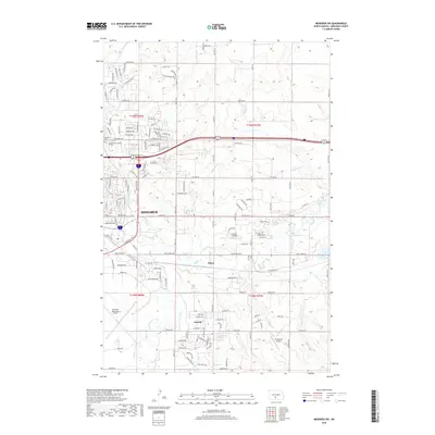
2018 Map of Menoken SW
USGS Topo · Published 2018About this map
Bismarck and its southeastern expansion define this landscape, where urban grid systems transition into the outlying residential developments of Lincoln and the community of Pierce. The eastern edge of the city is marked by institutional landmarks including the Fairview Cem and Bismarck Jewish Cem, while the regional infrastructure is anchored by the Bismarck Municipal Airport in the southwest. A network of smaller private airfields, such as Sauter Airport and Cloud Nine Airport, reflects the area's aviation-oriented character. The terrain is naturally segmented by the meandering path of Apple Creek, which flows through the southern half of the map, and Hay Cr to the north. Survey lines for t138n r80w and t139n r79w provide the framework for a mix of modern suburban subdivisions with names like Benteen Dr and Custer Dr and the remaining open lands of Burleigh County.
Find a feature on this map
115 named features on this map. Tap any name to fly to it.
Don’t see what you’re looking for? This feature index may not catch every label — zoom into the map to look around manually.
Map Details
Editions of this 2018 Menoken SW Map
This is the sole edition of this map. No revisions or reprints were ever made.
Other maps of this area

1907 · Bismarck
USGS Topo · 1:125,000

1950 · Bismarck
USGS Topo · 1:24,000

1951 · Menoken SW
USGS Topo · 1:24,000

1951 · Bismarck
USGS Topo · 1:62,500

1951 · Menoken
USGS Topo · 1:62,500

1954 · Bismarck
USGS Topo · 1:250,000

1958 · Bismarck
USGS Topo · 1:250,000

1962 · Sugarloaf Butte
USGS Topo · 1:24,000

1962 · Schmidt
USGS Topo · 1:24,000

1962 · Menoken SW
USGS Topo · 1:24,000