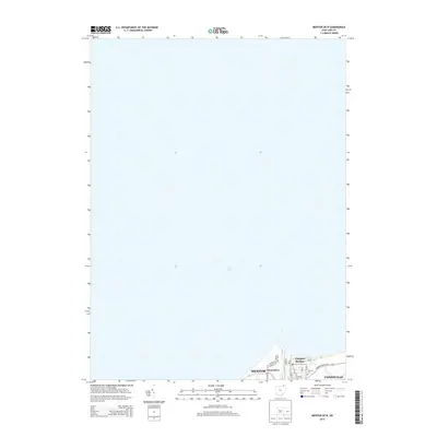
2013 Map of Mentor OE N
USGS Topo · Published 2013About this map
Lake Erie dominates the northern expanse of this Lake County shoreline, where the Grand River meets the open water at the village of Fairport Harbor. The map documents a heavily developed industrial and residential maritime landscape, focusing on the infrastructure supporting the harbor. Settlement patterns follow the river's curve, with the village of Grand River tucked into the western bank. Local genealogy and history researchers can trace the detailed street grids of these lakefront communities, including landmarks like the Lutheran Cem and the central Po in Fairport Harbor. The southern margin of the sheet captures the northern edges of Mentor and Painesville, showing the transition from dense lakeside docks and neighborhoods to the arterial connections of Fairport Nursery Rd and Heisley Rd.
Find a feature on this map
20 named features on this map. Tap any name to fly to it.
Don’t see what you’re looking for? This feature index may not catch every label — zoom into the map to look around manually.
Map Details
Editions of this 2013 Mentor OE N Map
This is the sole edition of this map. No revisions or reprints were ever made.
Other maps of this area

1904 · Chardon
USGS Topo · 1:62,500

1905 · Perry
USGS Topo · 1:62,500

1905 · Mentor
USGS Topo · 1:62,500

1906 · Chardon
USGS Topo · 1:62,500

1907 · Mentor
USGS Topo · 1:62,500

1950 · Cleveland
USGS Topo · 1:250,000

1953 · Mentor
USGS Topo · 1:24,000
1953 · Eastlake
USGS Topo · 1:24,000

1956 · Cleveland
USGS Topo · 1:250,000
1960 · Painesville
USGS Topo · 1:24,000