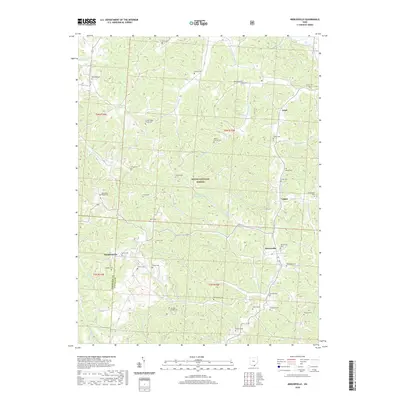
2019 Map of Mercerville
USGS Topo · Published 2019About this map
Wayne National Forest land covers much of this Gallia County landscape, where the terrain is defined by a dense network of streams such as Indian Guyan Creek and Raccoon Creek. Small settlements like Mercerville and Saundersville serve as anchor points in an area dominated by family-named cemeteries and rural chapels. Genealogists will find a wealth of specific burial sites, including the Lincoln Ridge Chapel Cemetery and Stewart Chapel Cemetery, which point to the long-standing community foundations in this corner of Ohio. The map also captures the varied topography of Angel and Leaper, with narrow valleys shaped by Claylick Run and Swan Creek. This detailed 2019 survey documents the enduring rural character of the region, from Nobles Paradise Lake to the various township boundaries like t3n r15w.
Find a feature on this map
59 named features on this map. Tap any name to fly to it.
Don’t see what you’re looking for? This feature index may not catch every label — zoom into the map to look around manually.
Map Details
Editions of this 2019 Mercerville Map
This is the sole edition of this map. No revisions or reprints were ever made.
Other maps of this area

1906 · Bidwell
USGS Topo · 1:62,500

1906 · Athalia
USGS Topo · 1:62,500

1906 · Glenwood
USGS Topo · 1:62,500

1908 · Bidwell
USGS Topo · 1:62,500

1908 · Athalia
USGS Topo · 1:62,500

1908 · Glenwood
USGS Topo · 1:62,500

1908 · Point Pleasant
USGS Topo · 1:62,500

1926 · Point Pleasant
USGS Topo · 1:62,500

1929 · Point Pleasant
USGS Topo · 1:62,500

1957 · Huntington
USGS Topo · 1:250,000