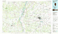
1985 Map of Meredosia
USGS Topo · Published 1988About this map
The Illinois River corridor anchors this 1980s landscape, serving as a vital artery between the grain elevators and river towns of West Central Illinois. In the city of Jacksonville, the presence of institutions like the Illinois School for the Deaf, Illinois School for the Visually Impaired, and Illinois College highlights the area's long-standing role as an educational and social hub. To the west, the river floodplain is home to the Meredosia National Wildlife Refuge and the La Grange Lock and Dam, which manages river traffic near Meredosia. The surrounding rural topography is defined by the dendritic drainage of the La Moine River and McKee Creek, supporting a patchwork of farms, quarries, and small settlements like Pittsfield and Griggsville that were historically connected by lines such as the Norfolk and Western railroad.
Find a feature on this map
235 named features on this map. Tap any name to fly to it.
Don’t see what you’re looking for? This feature index may not catch every label — zoom into the map to look around manually.
Map Details
Editions of this 1985 Meredosia Map
This is the sole edition of this map. No revisions or reprints were ever made.
Other maps of this area

1890 · Louisiana
USGS Topo · 1:125,000

1909 · Tallula
USGS Topo · 1:62,500

1923 · Carlinville
USGS Topo · 1:48,000

1923 · Rushville
USGS Topo · 1:62,500

1924 · Winchester
USGS Topo · 1:48,000

1924 · Waverly
USGS Topo · 1:62,500

1924 · Roodhouse
USGS Topo · 1:62,500

1924 · Griggsville
USGS Topo · 1:62,500

1925 · Carlinville
USGS Topo · 1:62,500

1925 · Liberty
USGS Topo · 1:62,500