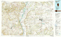
1990 Map of Meredosia
USGS Topo · Published 1990About this map
The Illinois River corridor dominates this 1990 survey, carving a wide valley through the heart of West Central Illinois. Along its banks, the Meredosia National Wildlife Refuge and Pike Co State Conservation Area preserve the river's ecological character, while the surrounding uplands are defined by an intricate network of tributaries like McKee Creek and Mauvaise Terre Creek. This landscape represents a mature agricultural and transport hub at the close of the twentieth century, where the Norfolk Southern Railway and Burlington Northern Railroad intersect the river's historic trade routes.
Find a feature on this map
111 named features on this map. Tap any name to fly to it.
Don’t see what you’re looking for? This feature index may not catch every label — zoom into the map to look around manually.
Map Details
Editions of this 1990 Meredosia Map
This is the sole edition of this map. No revisions or reprints were ever made.
Other maps of this area

1890 · Louisiana
USGS Topo · 1:125,000

1909 · Tallula
USGS Topo · 1:62,500

1923 · Carlinville
USGS Topo · 1:48,000

1923 · Rushville
USGS Topo · 1:62,500

1924 · Winchester
USGS Topo · 1:48,000

1924 · Waverly
USGS Topo · 1:62,500

1924 · Roodhouse
USGS Topo · 1:62,500

1924 · Griggsville
USGS Topo · 1:62,500

1925 · Carlinville
USGS Topo · 1:62,500

1925 · Liberty
USGS Topo · 1:62,500