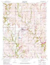
1952 Map of Meriden
USGS Topo · Published 1982About this map
Meriden serves as the central hub of this Kansas landscape, where the Atchison Topeka And Santa Fe railroad and highway corridor bisect the terrain. The map captures a complex drainage system defined by Rock Creek and its tributaries, including French Creek and Claywell Creek, alongside the southern presence of Little Muddy Creek. These waterways dictate the local geography, leading toward the significant shoreline of Perry Lake in the southeast corner.
Find a feature on this map
23 named features on this map. Tap any name to fly to it.
Don’t see what you’re looking for? This feature index may not catch every label — zoom into the map to look around manually.
Map Details
Editions of this 1952 Meriden Map
4 editions found
Other maps of this area

1886 · Oskaloosa
USGS Topo · 1:125,000

1888 · Oskaloosa
USGS Topo · 1:125,000

1889 · Topeka
USGS Topo · 1:125,000

1894 · Oskaloosa
USGS Topo · 1:125,000

1894 · Topeka
USGS Topo · 1:125,000

1949 · Perry
USGS Topo · 1:24,000

1950 · Perry
USGS Topo · 1:24,000

1950 · Kansas City
USGS Topo · 1:250,000

1950 · Topeka
USGS Topo · 1:24,000

1950 · Grantville
USGS Topo · 1:24,000