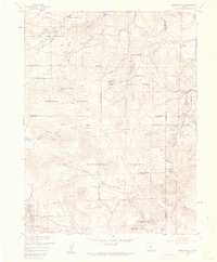
1957 Map of Meridian Hill
USGS Topo · Published 1961About this map
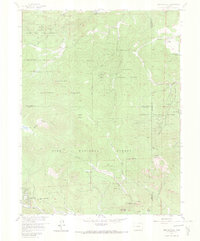
Arapaho National Forest and Pike National Forest dominate this high-altitude landscape, where several mountain-country ranches and youth camps were established by the late 1950s. The map captures a transition between the State Game and Fish Reserve in the northwest and the developing community of Harris Park in the south, connected by the Harris Park Road. Religious and recreational history is anchored by Our Lady of the Rockies Camp and Singing River Ranch, reflecting the area's mid-century role as a retreat from the growing Front Range. Water management and conservation are central to the terrain, evidenced by the Elk Management Headquarters near Bear Creek. From the heights of Meridian Hill and Shadow Mountain down to the dramatic drop of Elk Falls, the map details a network of gulches and creeks like Parmakian Gulch and North Fork Elk Creek that defined early drainage patterns in these Colorado highlands.
Find a feature on this map
38 named features on this map. Tap any name to fly to it.
Don’t see what you’re looking for? This feature index may not catch every label — zoom into the map to look around manually.
Map Details
Editions of this 1957 Meridian Hill Map
7 editions found
Other maps of this area

1893 · Platte Canyon
USGS Topo · 1:125,000

1899 · West Denver
USGS Topo · 1:125,000

1903 · Georgetown
USGS Topo · 1:62,500

1905 · Georgetown
USGS Topo · 1:62,500

1945 · Pine
USGS Topo · 1:24,000

1945 · Bailey
USGS Topo · 1:24,000

1945 · Shawnee
USGS Topo · 1:24,000

1948 · Pine
USGS Topo · 1:24,000

1948 · Shawnee
USGS Topo · 1:24,000

1949 · Bailey
USGS Topo · 1:24,000