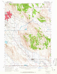
1957 Map of Merrill
USGS Topo · Published 1965About this map
Stukel Mountain and Hogback Mountain anchor this 1957 survey of the borderlands between Oregon and California. The landscape is defined by an intricate network of irrigation, featuring the Northern Canal, Eastern Canal, and Van Brimmer Canal which feed the agricultural valley. The Lost River meanders through the center of the sheet, passing through The Gap and eventually reaching the town of Merrill. The settlement of Altamont shows significant development in the northwest, complete with the Drive-in Theater, Shasta School, and Klamath Falls Municipal Airport. This era captures the region's reliance on both the Southern Pacific and Great Northern railroads to move goods through the basin. Smaller communities like Olene, Dairy, and Hager are documented alongside local landmarks such as the Stone Bridge and the 100F Cemetery.
Find a feature on this map
67 named features on this map. Tap any name to fly to it.
Don’t see what you’re looking for? This feature index may not catch every label — zoom into the map to look around manually.
Map Details
Editions of this 1957 Merrill Map
2 editions found
Other maps of this area

1886 · Modoc Lava Bed
USGS Topo · 1:250,000

1889 · Klamath
USGS Topo · 1:250,000

1892 · Modoc Lava-Bed
USGS Topo · 1:250,000

1894 · Klamath
USGS Topo · 1:250,000

1950 · Mt. Dome
USGS Topo · 1:62,500

1950 · Dorris
USGS Topo · 1:62,500

1951 · Tulelake
USGS Topo · 1:62,500

1954 · Alturas
USGS Topo · 1:250,000

1955 · Klamath Falls
USGS Topo · 1:250,000

1957 · Merrill
USGS Topo · 1:62,500