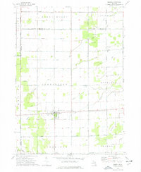
1973 Map of Merrill
USGS Topo · Published 1977About this map
Merrill serves as the primary hub of this rural landscape, situated at the intersection of a sprawling agricultural grid and the Chesapeake and Ohio railroad. The map reveals the organized township structures of Jonesfield, Richland, Mount Haley, and Ingersoll, where family-named roads like O'Hara Road and Weeks Road divide the land. Small clusters such as Iva and Jam appear as quiet outposts connected by a network of drainage ways and creeks, including Weeks Creek and Handy Creek.
Find a feature on this map
45 named features on this map. Tap any name to fly to it.
Don’t see what you’re looking for? This feature index may not catch every label — zoom into the map to look around manually.
Map Details
Editions of this 1973 Merrill Map
This is the sole edition of this map. No revisions or reprints were ever made.
Other maps of this area

1917 · St. Charles
USGS Topo · 1:62,500

1934 · Sanford
USGS Topo · 1:62,500

1934 · Merrill
USGS Topo · 1:62,500

1936 · Sanford
USGS Topo · 1:62,500

1937 · Merrill
USGS Topo · 1:62,500

1943 · St. Charles
USGS Topo · 1:62,500

1954 · Midland
USGS Topo · 1:250,000

1958 · Midland
USGS Topo · 1:250,000

1959 · Midland
USGS Topo · 1:250,000

1962 · Midland South
USGS Topo · 1:24,000