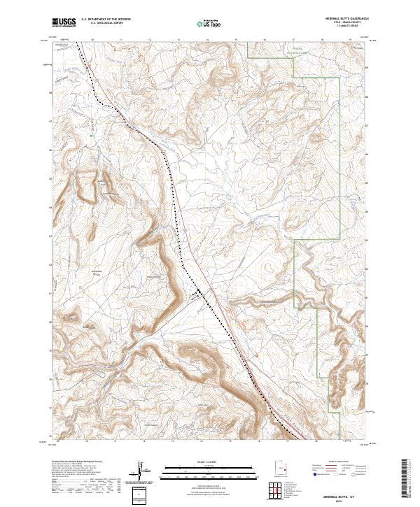
2023 Map of Merrimac Butte
USGS Topo · Published 2023About this map
Merrimac Butte and its neighbor Monitor Butte dominate this landscape north of Moab, where the high desert is defined by sprawling mesas and deep canyons. To the northeast, the boundary of Arches National Park meets Courthouse Wash, while the western terrain is marked by expansive grazing and mining tracks like Arths Pasture and Cotter Mine Rd. The network of trails and 4WD roads such as the Willow Springs Trl and Nw Sovereign Trl suggests a modern era of recreation overlaying older industrial and ranching routes. Geological landmarks are abundant throughout the quadrangle, including the massive Courthouse Rock, Slickensides Arch, and the aptly named Uranium Arch, reflecting the region's mid-century prospecting history. Modern transit is also represented by the Moab Canyon Pathway and the current highway corridor cutting across Cedar Ridge.
Find a feature on this map
36 named features on this map. Tap any name to fly to it.
Don’t see what you’re looking for? This feature index may not catch every label — zoom into the map to look around manually.
Map Details
Editions of this 2023 Merrimac Butte Map
This is the sole edition of this map. No revisions or reprints were ever made.
Other maps of this area

1885 · La Sal
USGS Topo · 1:250,000

1951 · The Knoll
USGS Topo · 1:62,500

1952 · Moab 4 NW
USGS Topo · 1:24,000

1952 · Moab 3 NE
USGS Topo · 1:24,000

1952 · Moab 3 SE
USGS Topo · 1:24,000

1952 · Moab 4 SW
USGS Topo · 1:24,000

1956 · Moab
USGS Topo · 1:250,000

1958 · Crescent Junction
USGS Topo · 1:62,500

1958 · Thompson
USGS Topo · 1:62,500

1959 · Moab
USGS Topo · 1:250,000