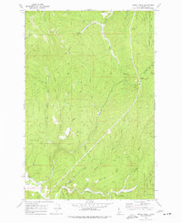
1969 Map of Merry Creek
USGS Topo · Published 1977About this map
The settlement of Clarkia sits along the Middle Fork St Maries River in this 1969 topographical study, serving as a hub for the surrounding logging and transit networks. The landscape is defined by the steep drainages of the St Joe National Forest, where an Old Railroad Grade winds through the hills north of Merry Creek, marking the footprint of earlier timber extraction and rail infrastructure. Higher elevations are anchored by Swan Peak and Davies Pass, while numerous creeks like Bussel Creek and Gold Center Creek feed the larger river system.
Find a feature on this map
31 named features on this map. Tap any name to fly to it.
Don’t see what you’re looking for? This feature index may not catch every label — zoom into the map to look around manually.
Map Details
Editions of this 1969 Merry Creek Map
2 editions found
Other maps of this area

1955 · Pullman
USGS Topo · 1:250,000

1955 · Spokane
USGS Topo · 1:250,000

1958 · Spokane
USGS Topo · 1:250,000

1958 · Pullman
USGS Topo · 1:250,000

1961 · Fernwood
USGS Topo · 1:62,500

1961 · Bovill
USGS Topo · 1:62,500

1969 · Marble Mountain
USGS Topo · 1:24,000

1969 · Anthony Peak
USGS Topo · 1:24,000

1969 · Grandmother Mtn
USGS Topo · 1:24,000
1969 · Grice Ridge
USGS Topo · 1:24,000