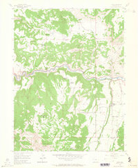
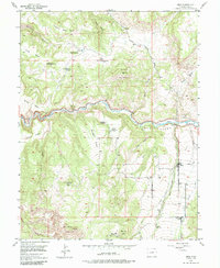
1955 Map of Mesa
USGS Topo · Published 1964About this map
Plateau Creek carves a deep valley through the high country of Western Colorado, anchoring a landscape where post-war ranching met the remains of earlier pioneer efforts. By the mid-1950s, the small settlement of Mesa served as the primary hub for this stretch of the Plateau Valley, while numerous family sites like the Atwell Homestead and Morris Ranch remained active. The map records a shift in the high-desert economy, noting several earlier pioneer sites as abandoned, including the Eddington Homestead and Carver Homestead.
Find a feature on this map
38 named features on this map. Tap any name to fly to it.
Don’t see what you’re looking for? This feature index may not catch every label — zoom into the map to look around manually.
Map Details
Editions of this 1955 Mesa Map
6 editions found
Other maps of this area

1929 · Grand Valley
USGS Topo · 1:62,500

1929 · Roan Creek
USGS Topo · 1:62,500

1955 · Cameo
USGS Topo · 1:24,000

1955 · Mesa
USGS Topo · 1:24,000

1955 · Molina
USGS Topo · 1:24,000

1955 · Skyway
USGS Topo · 1:24,000

1956 · Grand Junction
USGS Topo · 1:250,000

1959 · Grand Junction
USGS Topo · 1:250,000

1960 · Grand Junction
USGS Topo · 1:250,000

1962 · Grand Junction
USGS Topo · 1:250,000