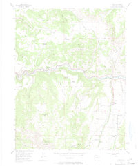
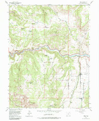
1955 Map of Mesa
USGS Topo · Published 1974About this map
Plateau Creek Valley dominates this mid-century landscape in Mesa County, revealing a transition from active ranching to early reclamation and abandonment. While the small settlement of Mesa serves as a local hub, the surrounding terrain is marked by numerous departed residences. High-elevation living is evidenced by sites like the Eddington Homestead (Aband) near East Monument and the Harris Homestead (Aband) further east.
Find a feature on this map
74 named features on this map. Tap any name to fly to it.
Don’t see what you’re looking for? This feature index may not catch every label — zoom into the map to look around manually.
Map Details
Editions of this 1955 Mesa Map
6 editions found
Other maps of this area

1929 · Grand Valley
USGS Topo · 1:62,500

1929 · Roan Creek
USGS Topo · 1:62,500

1955 · Cameo
USGS Topo · 1:24,000

1955 · Mesa
USGS Topo · 1:24,000

1955 · Molina
USGS Topo · 1:24,000

1955 · Skyway
USGS Topo · 1:24,000

1956 · Grand Junction
USGS Topo · 1:250,000

1959 · Grand Junction
USGS Topo · 1:250,000

1960 · Grand Junction
USGS Topo · 1:250,000

1962 · Grand Junction
USGS Topo · 1:250,000