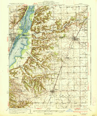
1937 Map of Metamora
USGS Topo · Published 1937About this map
The Illinois River dominates the western edge of this landscape, its wide floodplain carved into a complex system of backwaters including Goose Lake, Douglas Lake, and Meadow Lake. These waters are separated by named sloughs like Babb Slough and Sawyer Slough, indicating a highly dynamic river environment before modern stabilization. On the bluffs above the river, the village of Chillicothe and its neighbor North Chillicothe serve as vital rail hubs, positioned where the Chicago Rock Island and Pacific and Atchison Topeka and Santa Fe railroads converge.
Find a feature on this map
81 named features on this map. Tap any name to fly to it.
Don’t see what you’re looking for? This feature index may not catch every label — zoom into the map to look around manually.
Map Details
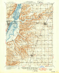
Editions of this 1937 Metamora Map
3 editions found

Other maps of this area

1893 · Lacon
USGS Topo · 1:62,500

1893 · Metamora
USGS Topo · 1:62,500

1893 · Dunlap
USGS Topo · 1:62,500

1898 · Dunlap
USGS Topo · 1:62,500

1905 · Peoria
USGS Topo · 1:62,500

1927 · Peoria
USGS Topo · 1:62,500

1927 · Danvers
USGS Topo · 1:62,500

1928 · Mackinaw
USGS Topo · 1:62,500

1930 · Danvers
USGS Topo · 1:62,500

1932 · Mackinaw
USGS Topo · 1:62,500