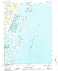
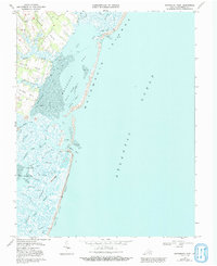
1968 Map of Metomkin Inlet
USGS Topo · Published 1984About this map
Metomkin Islands and the barrier coast of Accomack County are depicted in this mid-century topographic record, showing the shifting relationship between the Atlantic Ocean and the sheltered waters of Metomkin Bay. The landscape is dominated by tidal flats and a complex network of channels, including the Warwick Channel and Running Channel, which facilitate navigation behind the protective barrier of Metomkin Island. On the mainland, small settlements like Parker and Joynes sit at the ends of productive land necks such as Parker Neck and Joynes Neck, where the terrain transitions into the salt marshes. Key maritime features include the Virginia Inside Passage, a Lookout Tower, and a Boat Landing, reflecting a coast defined by water-based transit and resource harvesting. The intricate drainage through Folly Creek and Great Channel illustrates the environmental pressures on this fragile Eastern Shore shoreline.
Find a feature on this map
45 named features on this map. Tap any name to fly to it.
Don’t see what you’re looking for? This feature index may not catch every label — zoom into the map to look around manually.
Map Details
Editions of this 1968 Metomkin Inlet Map
5 editions found
Other maps of this area

1931 · Accomac
USGS Topo · 1:48,000

1935 · Accomac
USGS Topo · 1:62,500

1942 · Mappsville
USGS Topo · 1:24,000

1942 · Wallops Island
USGS Topo · 1:24,000

1942 · Parksley
USGS Topo · 1:24,000

1943 · Parksley
USGS Topo · 1:31,680

1943 · Mappsville
USGS Topo · 1:31,680

1943 · Wallops Island
USGS Topo · 1:31,680

1946 · Eastville
USGS Topo · 1:250,000
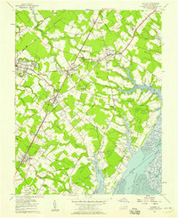
1957 · Accomac
USGS Topo · 1:24,000