
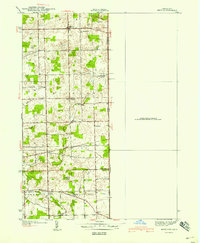
1940 Map of Metz
USGS Topo · Published 1940About this map
Metz and Alvarado anchor this rural landscape along the Indiana-Ohio border in the late 1930s, where small farming communities are defined by their local institutions and bridge crossings. The area is heavily intersected by an intricate drainage system, featuring Creel Ditch, Edna Ditch, and Baker Ditch, which supported the agricultural development of York, Richland, and Franklin townships.
Find a feature on this map
29 named features on this map. Tap any name to fly to it.
Don’t see what you’re looking for? This feature index may not catch every label — zoom into the map to look around manually.
Map Details
Editions of this 1940 Metz Map
2 editions found
Other maps of this area

1914 · Pioneer
USGS Topo · 1:62,500

1914 · Bryan
USGS Topo · 1:62,500

1939 · Hamilton
USGS Topo · 1:24,000

1939 · Angola East
USGS Topo · 1:24,000

1939 · Clear Lake
USGS Topo · 1:24,000

1940 · Clear Lake
USGS Topo · 1:24,000

1943 · Bryan
USGS Topo · 1:62,500

1944 · Pioneer
USGS Topo · 1:62,500

1947 · Angola East
USGS Topo · 1:24,000

1948 · Hamilton
USGS Topo · 1:24,000