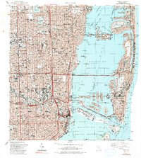
1988 Map of Miami
USGS Topo · Published 1992About this map
Biscayne Bay and its complex network of man-made islands dominate the eastern portion of this late-century survey, reflecting decades of coastal development. The map details the dense urban infrastructure connecting Miami to Miami Beach via the Julia Tuttle Causeway, MacArthur Causeway, and John Kennedy Causeway. Prominent interior landmarks include the iconic Orange Bowl Stadium and the Miami Arena, while the western neighborhoods like Allapattah and Shenandoah show a mature street grid integrated with the Seaboard System railroad. Historically significant sites such as Lincoln Memorial Park (Cem) and Evergreen Memorial Park (Cem) are clearly marked alongside old shoreline settlements like Lemon City and Little River. The harbor's industrial character is evident at Dodge Island and Lummus Island, critical hubs for the city's maritime economy.
Find a feature on this map
109 named features on this map. Tap any name to fly to it.
Don’t see what you’re looking for? This feature index may not catch every label — zoom into the map to look around manually.
Map Details
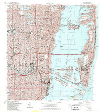
Editions of this 1988 Miami Map
2 editions found
Other maps of this area

1947 · North Miami
USGS Topo · 1:24,000

1947 · Key Biscayne
USGS Topo · 1:24,000

1949 · Opalocka
USGS Topo · 1:24,000

1949 · Key Biscayne
USGS Topo · 1:24,000

1950 · Hialeah
USGS Topo · 1:24,000

1950 · Miami
USGS Topo · 1:24,000

1950 · North Miami
USGS Topo · 1:24,000

1950 · South Miami
USGS Topo · 1:24,000

1956 · South Miami
USGS Topo · 1:24,000

1956 · Miami
USGS Topo · 1:250,000