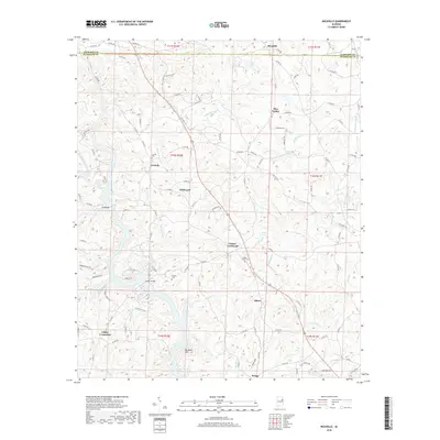
2018 Map of Micaville
USGS Topo · Published 2018About this map
The border of Cleburne and Randolph Counties bisects the northern reaches of this landscape, where rural communities like Micaville and Pine Tuckey developed along a network of winding roads. This 2018 survey documents a region defined by its ridge-and-valley topography, culminating in the elevation of Plunkett Mtn. The southern portion of the map is dominated by the sprawling fingers of the R L Harris Reservoir, which altered the natural course of local waterways like Sandy Cr and Sailor Cr.
Find a feature on this map
116 named features on this map. Tap any name to fly to it.
Don’t see what you’re looking for? This feature index may not catch every label — zoom into the map to look around manually.
Map Details
Editions of this 2018 Micaville Map
This is the sole edition of this map. No revisions or reprints were ever made.
Other maps of this area

1889 · Tallapoosa
USGS Topo · 1:125,000

1891 · Ashland
USGS Topo · 1:125,000

1892 · Tallapoosa
USGS Topo · 1:125,000

1897 · Tallapoosa
USGS Topo · 1:125,000

1899 · Wedowee
USGS Topo · 1:125,000

1900 · Anniston
USGS Topo · 1:125,000

1902 · Wedowee
USGS Topo · 1:125,000

1953 · Atlanta
USGS Topo · 1:250,000

1957 · Atlanta
USGS Topo · 1:250,000

1958 · Atlanta
USGS Topo · 1:250,000