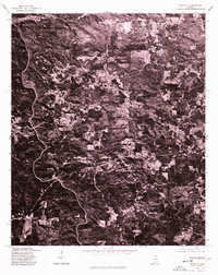
1975 Map of Micaville
USGS Topo · Published 1977About this map
Micaville serves as the namesake hub of this 1970s orthophotograph, a specialized format that combines the topographical accuracy of a map with the raw visual detail of aerial photography. Located in Randolph County, the area is characterized by a dense network of winding country roads and clearing patterns that reveal the agricultural and timber-driven life of the Alabama piedmont. Small rural junctions like Foster Crossroad and Fuller Crossroad anchor the landscape, showing the traditional settlement pattern of the region before significant modern development. By using 1975 imagery from the Soil Conservation Service, this map provides a rare, clear view of land-use boundaries and forest cover that traditional line-drawn maps often omit, making it an essential resource for tracing 20th-century family homesteads and land tracts.
Find a feature on this map
3 named features on this map. Tap any name to fly to it.
Don’t see what you’re looking for? This feature index may not catch every label — zoom into the map to look around manually.
Map Details
Editions of this 1975 Micaville Map
This is the sole edition of this map. No revisions or reprints were ever made.
Other maps of this area

1889 · Tallapoosa
USGS Topo · 1:125,000

1891 · Ashland
USGS Topo · 1:125,000

1892 · Tallapoosa
USGS Topo · 1:125,000

1897 · Tallapoosa
USGS Topo · 1:125,000

1899 · Wedowee
USGS Topo · 1:125,000

1900 · Anniston
USGS Topo · 1:125,000

1902 · Wedowee
USGS Topo · 1:125,000

1953 · Atlanta
USGS Topo · 1:250,000

1957 · Atlanta
USGS Topo · 1:250,000

1958 · Atlanta
USGS Topo · 1:250,000