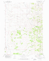
1971 Map of Michaud Creek
USGS Topo · Published 1974About this map
Fort Hall Indian Reservation Boundary and the Caribou National Forest converge in this high-desert and canyon landscape of eastern Idaho. This 1971 survey captures a network of spring-fed drainages including Michaud Creek, Bannock Creek, and Birch Creek that define the local topography. Human presence is marked by utility and agricultural infrastructure, such as the prominent Radio Facility, numerous Storage Bins, and a Corral.
Find a feature on this map
33 named features on this map. Tap any name to fly to it.
Don’t see what you’re looking for? This feature index may not catch every label — zoom into the map to look around manually.
Map Details
Editions of this 1971 Michaud Creek Map
2 editions found
Other maps of this area

1934 · Michaud
USGS Topo · 1:62,500

1937 · Pocatello
USGS Topo · 1:48,000

1937 · Michaud
USGS Topo · 1:62,500

1938 · Pauline
USGS Topo · 1:48,000

1944 · Pocatello
USGS Topo · 1:62,500

1944 · Arbon
USGS Topo · 1:62,500

1954 · Pocatello
USGS Topo · 1:250,000

1958 · Pocatello
USGS Topo · 1:250,000

1968 · Clifton Creek
USGS Topo · 1:24,000
1971 · Pocatello North
USGS Topo · 1:24,000