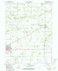
1961 Map of Michigantown
USGS Topo · Published 1981About this map
Michigantown and the surrounding Clinton County agricultural lands appear here as they were during the early 1960s, with later updates showing the expansion of the Frankfort city limits. The landscape is defined by its rectilinear road grid and several notable family and community burial grounds, including the Old Liberty Cem, Old Whiteman Cem, and Brandon Cem. The Norfolk and Western railroad corridor serves as a primary industrial spine, connecting smaller hubs like Avery and Boyleston to the larger centers.
Find a feature on this map
44 named features on this map. Tap any name to fly to it.
Don’t see what you’re looking for? This feature index may not catch every label — zoom into the map to look around manually.
Map Details
Editions of this 1961 Michigantown Map
2 editions found
Other maps of this area

1953 · Danville
USGS Topo · 1:250,000

1955 · Danville
USGS Topo · 1:250,000

1956 · Danville
USGS Topo · 1:250,000

1961 · Michigantown
USGS Topo · 1:24,000

1961 · Russiaville
USGS Topo · 1:24,000

1961 · Mechanicsburg
USGS Topo · 1:24,000

1961 · Hillisburg
USGS Topo · 1:24,000

1961 · Rossville
USGS Topo · 1:24,000

1961 · Burlington
USGS Topo · 1:24,000

1961 · Frankfort
USGS Topo · 1:24,000