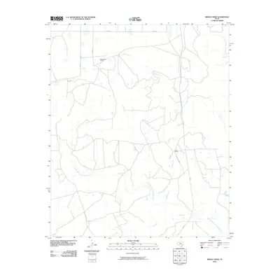
2010 Map of Middle Creek
USGS Topo · Published 2010About this map
Middle Creek winds through this West Texas landscape, leading toward its confluence with the Double Mountain Fork Brazos River in the southern portion of the quadrangle. This 2010 survey illustrates the vast ranching reaches of Garza County, dominated by large family-named holdings such as the U Lazy S Ranch and its associated U Lazy S Rch Rd. The settlement pattern is defined by rural infrastructure, where private air travel is facilitated by the Macy Ranch Airport near Macy Rd. The terrain is further etched by drainage systems including Salt Creek, which crosses the southern plains near FM 669. The map's grid of county roads, such as Co RD 290 and Co RD 145, reveals the methodical division of land in this cattle-country region, providing a clear record of property access and water distribution at the turn of the decade.
Find a feature on this map
11 named features on this map. Tap any name to fly to it.
Don’t see what you’re looking for? This feature index may not catch every label — zoom into the map to look around manually.
Map Details
Editions of this 2010 Middle Creek Map
This is the sole edition of this map. No revisions or reprints were ever made.
Other maps of this area

1954 · Lubbock
USGS Topo · 1:250,000

1954 · Big Spring
USGS Topo · 1:250,000

1958 · Big Spring
USGS Topo · 1:250,000

1969 · Gail NE
USGS Topo · 1:24,000

1969 · Beal Hollow
USGS Topo · 1:24,000

1969 · Indian Canyon NE
USGS Topo · 1:24,000

1969 · Post East
USGS Topo · 1:24,000

1969 · Grassland SE
USGS Topo · 1:24,000

1969 · Post West
USGS Topo · 1:24,000

1969 · Cooper Creek
USGS Topo · 1:24,000