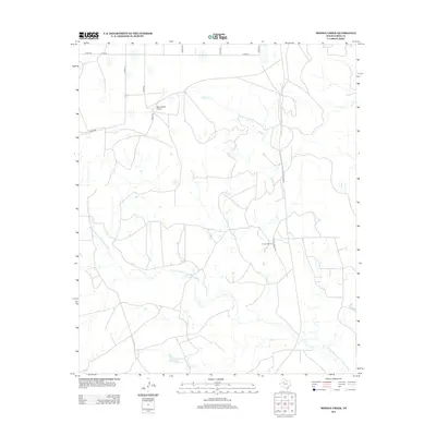
2012 Map of Middle Creek
USGS Topo · Published 2012About this map
Double Mountain Fork Brazos River winds through this expanse of Garza County, carving a distinct path through the West Texas landscape. The 2012 survey illustrates a region defined by large-scale ranching operations and the infrastructure required to maintain them, notably the U Lazy S Ranch and its associated U Lazy S Ranch Rd. To the north, the Macy Ranch Airport serves as a remote hub for the Macy Rd area, emphasizing the distance and scale of these landholdings. Small intermittent waterways like Middle Cr and Salt Cr feed into the larger river system, while a grid of county roads, including Co RD-290 and Co RD-141, provides the primary means of traversal across the open plains. This map captures the modern footprint of traditional Texas cattle country, where specialized ranch names still dominate the local geography.
Find a feature on this map
16 named features on this map. Tap any name to fly to it.
Don’t see what you’re looking for? This feature index may not catch every label — zoom into the map to look around manually.
Map Details
Editions of this 2012 Middle Creek Map
This is the sole edition of this map. No revisions or reprints were ever made.
Other maps of this area

1954 · Lubbock
USGS Topo · 1:250,000

1954 · Big Spring
USGS Topo · 1:250,000

1958 · Big Spring
USGS Topo · 1:250,000

1969 · Gail NE
USGS Topo · 1:24,000

1969 · Beal Hollow
USGS Topo · 1:24,000

1969 · Indian Canyon NE
USGS Topo · 1:24,000

1969 · Post East
USGS Topo · 1:24,000

1969 · Grassland SE
USGS Topo · 1:24,000

1969 · Post West
USGS Topo · 1:24,000

1969 · Cooper Creek
USGS Topo · 1:24,000