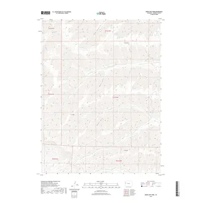
2019 Map of Middle Dry Fork
USGS Topo · Published 2019About this map
Kimball Mtn and Horse Mtn define this Garfield County landscape, where the high-elevation terrain is carved by complex drainages. The hydrologic network is centered around the Middle Dry Fork and its tributaries, including the N Dry Fork and McKay Fork. Numerous named springs, such as East Wiley Spring, West Wiley Spring, and Blanc Spring, are vital water sources documented across the ridges and canyons. The presence of Sawmill Gulch suggests historical timber or milling activity, while the name Cow Ridge reflects the area's legacy of high-country grazing. This 2019 survey by the U.S. Geological Survey captures the intricate topography of Blanc Canyon and the surrounding wilderness as it remains today.
Find a feature on this map
25 named features on this map. Tap any name to fly to it.
Don’t see what you’re looking for? This feature index may not catch every label — zoom into the map to look around manually.
Map Details
Editions of this 2019 Middle Dry Fork Map
This is the sole edition of this map. No revisions or reprints were ever made.
Other maps of this area

1929 · Highmore
USGS Topo · 1:62,500

1929 · Roan Creek
USGS Topo · 1:62,500

1956 · Grand Junction
USGS Topo · 1:250,000

1959 · Grand Junction
USGS Topo · 1:250,000

1960 · Grand Junction
USGS Topo · 1:250,000

1962 · Grand Junction
USGS Topo · 1:250,000

1964 · Grand Junction
USGS Topo · 1:250,000

1964 · Henderson Ridge
USGS Topo · 1:24,000

1964 · Calf Canyon
USGS Topo · 1:24,000

1965 · Grand Junction
USGS Topo · 1:250,000