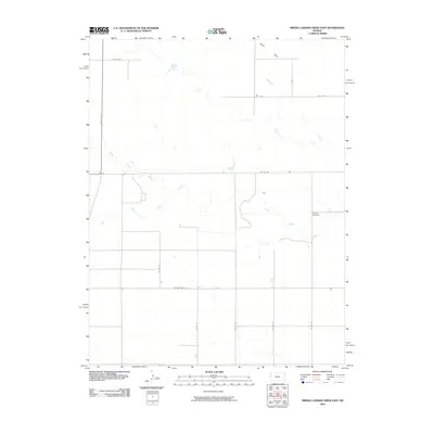
2010 Map of Middle Ladder Creek East
USGS Topo · Published 2010About this map
Ladder Creek and its southern tributaries define the drainage patterns across this High Plains landscape in Greeley County. The map captures a moment in the early twenty-first century where the vast agricultural sections are divided by a strict grid of county roads, including Thirteen Mile Rd and State Hwy 27. This rural topography is characterized by the broad, level expanses of the South Flats, providing a clear look at the large-scale land management typical of Western Kansas. Central to the local history of the area is Bethany Cemetery, situated near the banks of South Ladder Creek, serving as a genealogical touchstone for the surrounding township. The convergence of Middle Ladder Creek and its branches illustrates the subtle watercourses that have historically influenced settlement and road placement in this semi-arid region.
Find a feature on this map
17 named features on this map. Tap any name to fly to it.
Don’t see what you’re looking for? This feature index may not catch every label — zoom into the map to look around manually.
Map Details
Editions of this 2010 Middle Ladder Creek East Map
This is the sole edition of this map. No revisions or reprints were ever made.
Other maps of this area

1955 · Scott City
USGS Topo · 1:250,000

1958 · Scott City
USGS Topo · 1:250,000

1959 · Weskan
USGS Topo · 1:62,500

1959 · Wallace
USGS Topo · 1:62,500

1968 · Sharon Springs 3 NE
USGS Topo · 1:24,000

1968 · Sharon Springs 4 NW
USGS Topo · 1:24,000

1968 · Sharon Springs 4 NE
USGS Topo · 1:24,000

1970 · Sharon Springs 4 SE
USGS Topo · 1:24,000

1970 · Sharon Springs 3 SE
USGS Topo · 1:24,000

1970 · Sharon Springs 4 SW
USGS Topo · 1:24,000
Featured Places
- Tribune Township, KS
- Harrison Township, KS
- Sharon Springs Township, KS
- Wallace County, KS
- Greeley County, KS