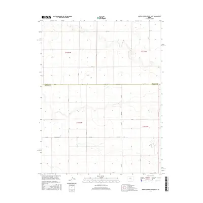
2016 Map of Middle Ladder Creek West
USGS Topo · Published 2016About this map
The high plains landscape where Wallace Co meets Greeley Co is defined by a rhythmic grid of rural routes and the meandering drainage of Middle Ladder Creek. This 2016 survey documents the agricultural and ranching infrastructure of Tribune Township, characterized by long-stretching corridors such as Thirteen Mile Rd and the aptly named Dusty Rd. The terrain is marked by gentle depressions and seasonal watercourses, with the section lines clearly delineated by the Public Land Survey System across townships like t15s r41w and t16s r40w. Local transit is supported by a network of county roads including Co Rd 1951 and Co Rd F, illustrating the persistent connectivity required for modern Great Plains farming. Notable for its evocative road names, the map includes Crosswind Raod and Bumpy Rd, which offer a character-rich look at how these remote western Kansas lands are navigated today.
Find a feature on this map
16 named features on this map. Tap any name to fly to it.
Don’t see what you’re looking for? This feature index may not catch every label — zoom into the map to look around manually.
Map Details
Editions of this 2016 Middle Ladder Creek West Map
This is the sole edition of this map. No revisions or reprints were ever made.
Other maps of this area

1955 · Scott City
USGS Topo · 1:250,000

1958 · Scott City
USGS Topo · 1:250,000

1959 · Weskan
USGS Topo · 1:62,500

1959 · Wallace
USGS Topo · 1:62,500

1968 · Sharon Springs 3 NE
USGS Topo · 1:24,000

1968 · Sharon Springs 4 NW
USGS Topo · 1:24,000

1968 · Sharon Springs 3 NW
USGS Topo · 1:24,000

1970 · Sharon Springs 3 SE
USGS Topo · 1:24,000

1970 · Sharon Springs 4 SW
USGS Topo · 1:24,000
1970 · Sharon Springs 3 SW
USGS Topo · 1:24,000
Featured Places
- Tribune Township, KS
- Weskan Township, KS
- Sharon Springs Township, KS
- Wallace County, KS
- Greeley County, KS