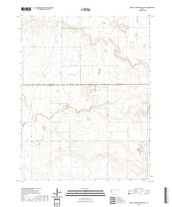
2022 Map of Middle Ladder Creek West
USGS Topo · Published 2022About this map
The Wallace Co and Greeley Co line defines the central axis of this High Plains landscape, where the High Plains terrain is etched by the intermittent drainages of the Middle Ladder Creek system. This 2022 survey captures a strictly rural environment structured by the Public Land Survey System, with section lines serving as the primary routes for local travel. Named roads like Dusty Rd, Bumpy Rd, and Thirteen Mile Rd reveal the utilitarian and descriptive nature of the local infrastructure. The north-south corridor of Horace Rd provides a primary link through the southern portion of the quadrangle. The sparse distribution of structures and the prevalence of unimproved roads like Crosswind Raod suggest an area dominated by large-scale ranching or dryland farming, where movement is dictated by the vast grid of the western Kansas prairie.
Find a feature on this map
27 named features on this map. Tap any name to fly to it.
Don’t see what you’re looking for? This feature index may not catch every label — zoom into the map to look around manually.
Map Details
Editions of this 2022 Middle Ladder Creek West Map
This is the sole edition of this map. No revisions or reprints were ever made.
Other maps of this area

1955 · Scott City
USGS Topo · 1:250,000

1958 · Scott City
USGS Topo · 1:250,000

1959 · Weskan
USGS Topo · 1:62,500

1959 · Wallace
USGS Topo · 1:62,500

1968 · Sharon Springs 3 NE
USGS Topo · 1:24,000

1968 · Sharon Springs 4 NW
USGS Topo · 1:24,000

1968 · Sharon Springs 3 NW
USGS Topo · 1:24,000

1970 · Sharon Springs 3 SE
USGS Topo · 1:24,000

1970 · Sharon Springs 4 SW
USGS Topo · 1:24,000
1970 · Sharon Springs 3 SW
USGS Topo · 1:24,000
Featured Places
- Weskan Township, KS
- Sharon Springs Township, KS
- Tribune Township, KS
- Greeley County, KS
- Wallace County, KS