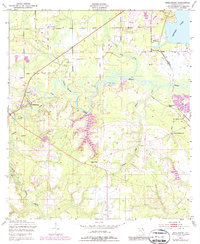
1949 Map of Middleburg
USGS Topo · Published 1972About this map
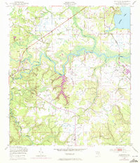
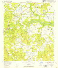
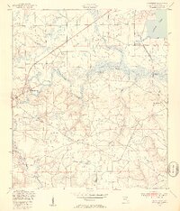
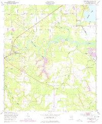
The confluence of the North Fork Black Creek and South Fork Black Creek defines the historic settlement of Middleburg, a central hub in Clay County at the mid-century. This 1949 survey, with revisions from 1970, illustrates a landscape defined by its waterways, where Black Creek meanders toward Doctors Lake. The map details the local infrastructure of the era, from the Seaboard Coast Line railroad near Doctors Inlet to the Foremost Airfield further south. Genealogists and local historians will find significant value in the distribution of rural congregations, including Black Pond Ch, Peoria Ch, and New Macedonia Ch. Industrial traces are also evident, such as the Kilns (Abandoned) and associated ruins near the shoreline, pointing to earlier manufacturing or resource extraction along the riverbanks.
Find a feature on this map
28 named features on this map. Tap any name to fly to it.
Don’t see what you’re looking for? This feature index may not catch every label — zoom into the map to look around manually.
Map Details
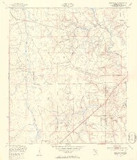
Editions of this 1949 Middleburg Map
5 editions found
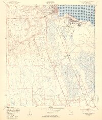
Other maps of this area

1917 · Orange Park
USGS Topo · 1:62,500

1918 · Middleburg
USGS Topo · 1:62,500

1918 · Orange Park
USGS Topo · 1:62,500

1941 · Middleburg
USGS Topo · 1:62,500

1942 · Ates Creek
USGS Topo · 1:62,500

1947 · Bostwick
USGS Topo · 1:50,000

1948 · Jacksonville
USGS Topo · 1:250,000
1949 · Middleburg SW
USGS Topo · 1:24,000
1949 · Green Cove Springs
USGS Topo · 1:24,000

1949 · Fiftone
USGS Topo · 1:24,000