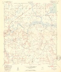
1949 Map of Middleburg
USGS Topo · Published 1953About this map
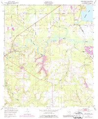
The confluence of the North Fork and South Fork of Black Creek forms the geographical heart of this Clay County landscape. Middleburg sits prominently at this junction, where the river system historically facilitated timber transport and early commerce. Further northeast, the settlement of Doctors Inlet borders the wide expanse of Doctors Lake, reflecting the area's transition toward the ST Johns River drainage. The terrain is marked by numerous low-lying wetlands and drainage features, including Bradley Creek, Peters Creek, and Polander Branch, which define the rural boundaries between early homesteads and airfields like Middleburg Airport and Foremost Airfield.
Find a feature on this map
2 named features on this map. Tap any name to fly to it.
Don’t see what you’re looking for? This feature index may not catch every label — zoom into the map to look around manually.
Map Details
Editions of this 1949 Middleburg Map
5 editions found
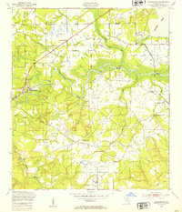
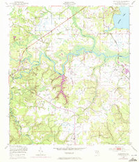
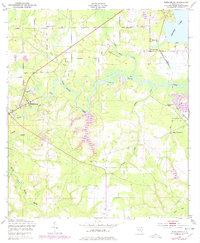
Other maps of this area

1917 · Orange Park
USGS Topo · 1:62,500

1918 · Middleburg
USGS Topo · 1:62,500

1918 · Orange Park
USGS Topo · 1:62,500

1941 · Middleburg
USGS Topo · 1:62,500

1942 · Ates Creek
USGS Topo · 1:62,500

1947 · Bostwick
USGS Topo · 1:50,000

1948 · Jacksonville
USGS Topo · 1:250,000
1949 · Middleburg SW
USGS Topo · 1:24,000
1949 · Green Cove Springs
USGS Topo · 1:24,000

1949 · Fiftone
USGS Topo · 1:24,000