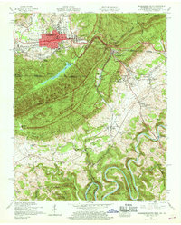
1959 Map of Middlesboro South
USGS Topo · Published 1968About this map
Cumberland Mountain forms the dominant spine of this landscape, where the historic Wilderness Road and Dixie Highway pass through the iconic Cumberland Gap. This mid-century survey documents the intersection of Kentucky, Tennessee, and Virginia at Tri-State Peak, overlooking the urban grid of Middlesboro to the north and the campus of Lincoln Memorial University near Harrogate to the south. The complex geography is defined by the Poor Valley and Powell Valley, where the Powell River meanders through distinct loops like Kings Bend and White Bend.
Find a feature on this map
108 named features on this map. Tap any name to fly to it.
Don’t see what you’re looking for? This feature index may not catch every label — zoom into the map to look around manually.
Map Details
Editions of this 1959 Middlesboro South Map
2 editions found
Other maps of this area

1886 · Cumberland Gap
USGS Topo · 1:125,000

1888 · Cumberland Gap
USGS Topo · 1:125,000

1891 · Cumberland Gap
USGS Topo · 1:125,000

1897 · Maynardville
USGS Topo · 1:125,000

1900 · Maynardville
USGS Topo · 1:125,000

1903 · Middlesboro
USGS Topo · 1:48,000

1927 · Middlesboro
USGS Topo · 1:62,500

1930 · Middlesboro
USGS Topo · 1:62,500

1935 · Varilla
USGS Topo · 1:24,000

1935 · Mingo Mountains
USGS Topo · 1:24,000