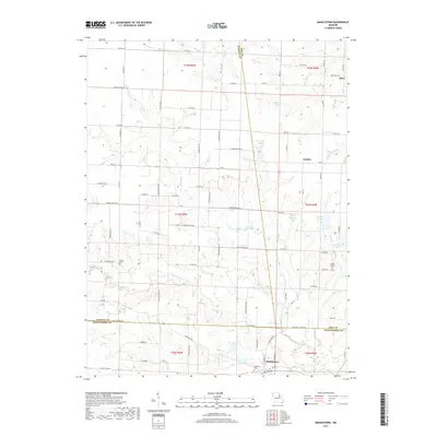
2017 Map of Middletown
USGS Topo · Published 2017About this map
Middletown serves as the primary hub of this rural Missouri landscape, situated near the intersection of Montgomery, Audrain, and Pike counties. The region is defined by the winding course of the W Fork Cuivre River and a dense network of tributaries including Sandy Cr, Johns Br, and Little Coon Cr. This modern survey reveals a landscape where historical burial grounds like Fairmount Cem, Payne Cem, and Rudd School Cem remain as markers of early community centers, even as smaller settlements like Gazette and Estes persist at crossroads. The prevalence of private water bodies, such as Clithero Lake, Wendells Lake, and Ehrlich Lake, reflects the contemporary land management patterns of the Missouri interior, while the intricate township and range divisions maintain the geometric order of the original land surveys.
Find a feature on this map
88 named features on this map. Tap any name to fly to it.
Don’t see what you’re looking for? This feature index may not catch every label — zoom into the map to look around manually.
Map Details
Editions of this 2017 Middletown Map
This is the sole edition of this map. No revisions or reprints were ever made.
Other maps of this area

1890 · Louisiana
USGS Topo · 1:125,000

1890 · Mexico
USGS Topo · 1:125,000

1942 · Wellsville
USGS Topo · 1:62,500

1942 · Bellflower
USGS Topo · 1:62,500

1943 · Vandalia
USGS Topo · 1:62,500

1945 · Bellflower
USGS Topo · 1:62,500

1945 · Perry
USGS Topo · 1:62,500

1945 · Vandalia
USGS Topo · 1:62,500

1948 · Quincy
USGS Topo · 1:250,000

1956 · Quincy
USGS Topo · 1:250,000