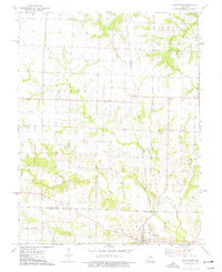
1973 Map of Middletown
USGS Topo · Published 1977About this map
Middletown serves as the primary hub in this rural landscape at the intersection of Montgomery, Pike, and Audrain counties. The village is surrounded by a network of family-held lands and community landmarks, including the Fairmount Cem on its northern edge. The topography is defined by the drainage systems of the West Fork Cuivre River and Sandy Creek, which carve through the townships of Indian, Hartford, and Prairie.
Find a feature on this map
25 named features on this map. Tap any name to fly to it.
Don’t see what you’re looking for? This feature index may not catch every label — zoom into the map to look around manually.
Map Details
Editions of this 1973 Middletown Map
This is the sole edition of this map. No revisions or reprints were ever made.
Other maps of this area

1890 · Louisiana
USGS Topo · 1:125,000

1890 · Mexico
USGS Topo · 1:125,000

1942 · Wellsville
USGS Topo · 1:62,500

1942 · Bellflower
USGS Topo · 1:62,500

1943 · Vandalia
USGS Topo · 1:62,500

1945 · Bellflower
USGS Topo · 1:62,500

1945 · Perry
USGS Topo · 1:62,500

1945 · Vandalia
USGS Topo · 1:62,500

1948 · Quincy
USGS Topo · 1:250,000

1956 · Quincy
USGS Topo · 1:250,000