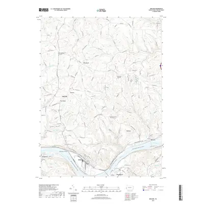
2019 Map of Midland
USGS Topo · Published 2019About this map
Industrial and riverfront activity along the Ohio River defines this portion of Beaver County, where the sprawling facility at Midland and the riverside communities of Georgetown and Shippingport face each other across the water. The landscape is deeply dissected by numerous runs including Sixmile Run, Wolf Run, and Fourmile Run, which carve through the plateau toward the river valley. On the higher ground north of the river, older crossroads and small settlements like Blackhawk, Fairview, and Five Points persist alongside extensive preservation areas such as State Game Lands 173.
Find a feature on this map
145 named features on this map. Tap any name to fly to it.
Don’t see what you’re looking for? This feature index may not catch every label — zoom into the map to look around manually.
Map Details
Editions of this 2019 Midland Map
This is the sole edition of this map. No revisions or reprints were ever made.
Other maps of this area

1901 · Beaver
USGS Topo · 1:62,500

1902 · New Castle
USGS Topo · 1:62,500

1904 · Newcastle
USGS Topo · 1:62,500

1904 · Wellsville
USGS Topo · 1:62,500

1904 · Beaver
USGS Topo · 1:62,500

1907 · Columbiana
USGS Topo · 1:62,500

1909 · Columbiana
USGS Topo · 1:62,500

1937 · Wellsville
USGS Topo · 1:62,500

1944 · Wellsville
USGS Topo · 1:62,500

1951 · Canton
USGS Topo · 1:250,000