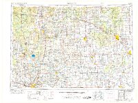
1954 Map of Midland
USGS Topo · Published 1974About this map
Grand Rapids anchor the southwestern corner of this mid-century survey, which reveals the transition from urban industry to the vast woodlands and water systems of central Michigan. The map details the mid-1950s infrastructure of the region, including the critical energy landscapes of the Oil field and Gas field developments that defined local economies during this era. Transport networks are prominently featured, with the Grand Trunk Western and Chesapeake and Ohio rail lines threading through settlements like Greenville, Big Rapids, and Owosso.
Find a feature on this map
192 named features on this map. Tap any name to fly to it.
Don’t see what you’re looking for? This feature index may not catch every label — zoom into the map to look around manually.
Map Details
Editions of this 1954 Midland Map
4 editions found

Other maps of this area

1914 · Grand Rapids
USGS Topo · 1:62,500

1916 · Bay City
USGS Topo · 1:62,500

1916 · Mount Pleasant
USGS Topo · 1:62,500

1916 · Ionia
USGS Topo · 1:62,500

1917 · Chesaning
USGS Topo · 1:62,500

1917 · St. Charles
USGS Topo · 1:62,500

1918 · Cedar Springs
USGS Topo · 1:62,500

1918 · Elsie
USGS Topo · 1:62,500

1918 · Ionia
USGS Topo · 1:62,500

1918 · Perrinton
USGS Topo · 1:62,500