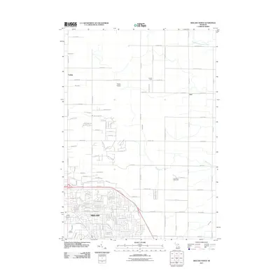
2011 Map of Midland North
USGS Topo · Published 2011About this map
Midland serves as the southern anchor of this 2011 map, showing the city's residential expansion and recreational sites such as Sandy Ridge Golf Course. The landscape north of the city limits transitions into a more rural pattern defined by an extensive drainage system, including Newell Drain, Miller Drain, and Waldo Drain, which supports the flat agricultural lands and low-lying areas. Small community hubs and historic intersections like Larkin, Duel, and Hubbard Circle dot the northern reaches, connected by a rigid grid of roads such as N Waldo Rd and Flajole Rd.
Find a feature on this map
112 named features on this map. Tap any name to fly to it.
Don’t see what you’re looking for? This feature index may not catch every label — zoom into the map to look around manually.
Map Details
Editions of this 2011 Midland North Map
This is the sole edition of this map. No revisions or reprints were ever made.
Other maps of this area

1934 · Sanford
USGS Topo · 1:62,500

1936 · Sanford
USGS Topo · 1:62,500

1954 · Midland
USGS Topo · 1:250,000

1958 · Midland
USGS Topo · 1:250,000

1959 · Midland
USGS Topo · 1:250,000

1962 · Willard
USGS Topo · 1:24,000

1962 · Midland South
USGS Topo · 1:24,000

1962 · Midland North
USGS Topo · 1:24,000
1962 · Auburn
USGS Topo · 1:24,000

1966 · Midland
USGS Topo · 1:250,000