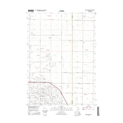
2014 Map of Midland North
USGS Topo · Published 2014About this map
Midland serves as the southern anchor for this Michigan survey, where urban residential streets transition into a strictly gridded agricultural landscape. The northern reaches are characterized by the small settlements of Larkin and Duel, set among a complex network of artificial and natural waterways designed to manage the low-lying terrain. Many of these channels, such as Waldo Drain, Pashok Drain, and Dingman Drain, follow the section lines of the Public Land Survey System, illustrating how drainage engineering has historically shaped the region's farming viability.
Find a feature on this map
175 named features on this map. Tap any name to fly to it.
Don’t see what you’re looking for? This feature index may not catch every label — zoom into the map to look around manually.
Map Details
Editions of this 2014 Midland North Map
This is the sole edition of this map. No revisions or reprints were ever made.
Other maps of this area

1934 · Sanford
USGS Topo · 1:62,500

1936 · Sanford
USGS Topo · 1:62,500

1954 · Midland
USGS Topo · 1:250,000

1958 · Midland
USGS Topo · 1:250,000

1959 · Midland
USGS Topo · 1:250,000

1962 · Willard
USGS Topo · 1:24,000

1962 · Midland South
USGS Topo · 1:24,000

1962 · Midland North
USGS Topo · 1:24,000
1962 · Auburn
USGS Topo · 1:24,000

1966 · Midland
USGS Topo · 1:250,000