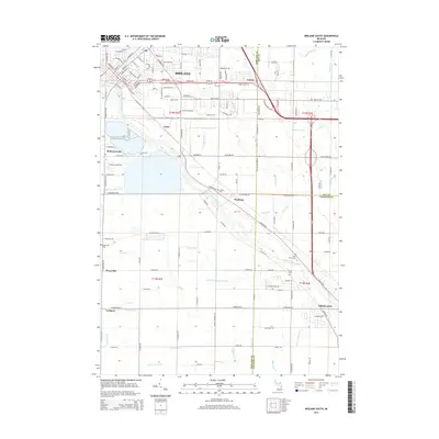
2014 Map of Midland South
USGS Topo · Published 2014About this map
The Tittabawassee River flows southeastward through this Michigan landscape, serving as a geographic anchor for the industrial and residential growth of south Midland. This 2014 survey captures the suburban and rural character of the region, from the dense street grids of Midland in the north to the quieter outlying settlements of Bullock Creek, Mapleton, and Freeland. The map reveals a complex network of man-made waterways designed to manage the flat terrain, including the Lingle Drain and Shaffner and Major Drain. Local history is preserved in the placement of several community landmarks, such as Pine Grove Cem near the riverbanks and the Poseyville Cem to the west. These details, alongside the many named drainage features like Parker Swamp Drain and Thurlow Tile Drain, offer a window into how the local environment has been shaped for agriculture and development over decades.
Find a feature on this map
130 named features on this map. Tap any name to fly to it.
Don’t see what you’re looking for? This feature index may not catch every label — zoom into the map to look around manually.
Map Details
Editions of this 2014 Midland South Map
This is the sole edition of this map. No revisions or reprints were ever made.
Other maps of this area

1917 · St. Charles
USGS Topo · 1:62,500

1934 · Sanford
USGS Topo · 1:62,500

1934 · Merrill
USGS Topo · 1:62,500

1936 · Sanford
USGS Topo · 1:62,500

1937 · Merrill
USGS Topo · 1:62,500

1943 · St. Charles
USGS Topo · 1:62,500

1954 · Midland
USGS Topo · 1:250,000

1958 · Midland
USGS Topo · 1:250,000

1959 · Midland
USGS Topo · 1:250,000

1962 · Willard
USGS Topo · 1:24,000