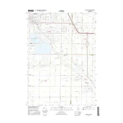
2017 Map of Midland South
USGS Topo · Published 2017About this map
The Tittabawassee River carves a diagonal path through this landscape, marking the transition from the urban reach of Midland toward the rural and residential outskirts of Freeland. The geography is defined by an extensive network of drainage systems, such as Zimmerman Drain and Shaffner and Major Drain, reflecting a long history of water management to support both industry and agriculture. Near the river, small settlements like Mapleton and Poseyville serve as anchor points for local history.
Find a feature on this map
152 named features on this map. Tap any name to fly to it.
Don’t see what you’re looking for? This feature index may not catch every label — zoom into the map to look around manually.
Map Details
Editions of this 2017 Midland South Map
This is the sole edition of this map. No revisions or reprints were ever made.
Other maps of this area

1917 · St. Charles
USGS Topo · 1:62,500

1934 · Sanford
USGS Topo · 1:62,500

1934 · Merrill
USGS Topo · 1:62,500

1936 · Sanford
USGS Topo · 1:62,500

1937 · Merrill
USGS Topo · 1:62,500

1943 · St. Charles
USGS Topo · 1:62,500

1954 · Midland
USGS Topo · 1:250,000

1958 · Midland
USGS Topo · 1:250,000

1959 · Midland
USGS Topo · 1:250,000

1962 · Willard
USGS Topo · 1:24,000