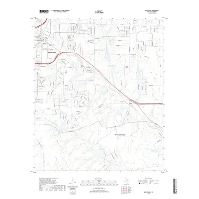
2019 Map of Midlothian
USGS Topo · Published 2019About this map
Midlothian and northern Waxahachie are shown here as they transition from rural Ellis County acreage into suburban corridors. The map records a landscape defined by its waterways, notably Waxahachie Creek and North Prong Creek, which wind through the terrain between evolving residential developments and larger ranch holdings like Diamond J Ranch Lake Number 2. Small, established communities like Sardis remain distinct, anchored by local landmarks such as Sardis Cemetery.
Find a feature on this map
77 named features on this map. Tap any name to fly to it.
Don’t see what you’re looking for? This feature index may not catch every label — zoom into the map to look around manually.
Map Details
Editions of this 2019 Midlothian Map
This is the sole edition of this map. No revisions or reprints were ever made.
Other maps of this area

1891 · Dallas
USGS Topo · 1:125,000

1891 · Cleburne
USGS Topo · 1:125,000

1893 · Dallas
USGS Topo · 1:125,000

1894 · Cleburne
USGS Topo · 1:125,000

1894 · Fort Worth
USGS Topo · 1:125,000

1954 · Dallas
USGS Topo · 1:250,000

1958 · Dallas
USGS Topo · 1:250,000
1959 · Lancaster
USGS Topo · 1:24,000
1959 · Cedar Hill
USGS Topo · 1:24,000
1959 · Britton
USGS Topo · 1:24,000