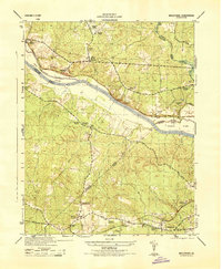
1944 Map of Midlothian
USGS Topo · Published 1944About this map
The James River corridor serves as the primary artery for transport and industry in the mid-1940s, defining the boundaries of Goochland, Henrico, Powhatan, and Chesterfield counties. Industrial activity is concentrated at the Boscobel Granite Quarries and along the Chesapeake and Ohio railroad, which parallels the river's northern bank. Local commerce and communal life are anchored by scattered settlements such as Midlothian, Manakin, and Sabot, alongside significant landmarks like Watkins Nurseries and the Huguenot Monument.
Find a feature on this map
39 named features on this map. Tap any name to fly to it.
Don’t see what you’re looking for? This feature index may not catch every label — zoom into the map to look around manually.
Map Details
Editions of this 1944 Midlothian Map
This is the sole edition of this map. No revisions or reprints were ever made.
Other maps of this area

1890 · Goochland
USGS Topo · 1:125,000

1892 · Goochland
USGS Topo · 1:125,000

1897 · Amelia
USGS Topo · 1:125,000

1936 · Richmond West
USGS Topo · 1:24,000

1936 · Glen Allen
USGS Topo · 1:24,000

1941 · Glen Allen
USGS Topo · 1:31,680

1942 · Westhampton
USGS Topo · 1:31,680

1943 · Fine Creek Mills
USGS Topo · 1:31,680

1943 · Chesterfield
USGS Topo · 1:31,680

1943 · Perkinsville
USGS Topo · 1:31,680