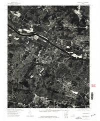
1974 Map of Midlothian
USGS Topo · Published 1977About this map
The James River cuts through the northern section of this 1974 orthophotoquad, serving as the dominant geographic landmark for this portion of Chesterfield County. Based on aerial photography from April 1974, this image-based survey provides a raw visual record of the land use and riparian corridor just west of Richmond. The imagery reveals a mix of dense forest, agricultural clearings, and the early stages of suburban residential development, capturing the tension between the region's rural roots and its increasing urbanization. Tracing the river's path through this landscape offers a direct look at the industrial and natural features of the James as they appeared in the mid-1970s, before decades of subsequent growth altered the shoreline and the surrounding Midlothian area.
Find a feature on this map
1 named feature on this map. Tap any name to fly to it.
Don’t see what you’re looking for? This feature index may not catch every label — zoom into the map to look around manually.
Map Details
Editions of this 1974 Midlothian Map
This is the sole edition of this map. No revisions or reprints were ever made.
Other maps of this area

1890 · Goochland
USGS Topo · 1:125,000

1892 · Goochland
USGS Topo · 1:125,000

1897 · Amelia
USGS Topo · 1:125,000

1936 · Richmond West
USGS Topo · 1:24,000

1936 · Glen Allen
USGS Topo · 1:24,000

1941 · Glen Allen
USGS Topo · 1:31,680

1942 · Westhampton
USGS Topo · 1:31,680

1943 · Fine Creek Mills
USGS Topo · 1:31,680

1943 · Chesterfield
USGS Topo · 1:31,680

1943 · Perkinsville
USGS Topo · 1:31,680