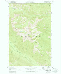
1969 Map of Midnight Mtn.
USGS Topo · Published 1986About this map
Okanogan National Forest covers this high-elevation landscape, where a network of trails serves as the primary infrastructure for traversing the steep ridges and basins. The topography is defined by prominent peaks such as Midnight Mountain and Three A M Mtn, with drainage systems flowing through narrow canyons like Canyon Creek and Whistling Creek. The presence of Gardner Meadows and several high-country lakes, including Slate Lake and Little Slate Lake, suggests a region utilized for seasonal grazing and remote recreation during the late 1960s.
Find a feature on this map
25 named features on this map. Tap any name to fly to it.
Don’t see what you’re looking for? This feature index may not catch every label — zoom into the map to look around manually.
Map Details
Editions of this 1969 Midnight Mtn. Map
2 editions found
Other maps of this area

1899 · Methow
USGS Topo · 1:125,000

1901 · Methow
USGS Topo · 1:125,000

1902 · Stehekin
USGS Topo · 1:125,000

1904 · Stehekin
USGS Topo · 1:125,000

1920 · Slate Pass
USGS Topo · 1:125,000

1955 · Concrete
USGS Topo · 1:250,000

1958 · Concrete
USGS Topo · 1:250,000

1962 · Concrete
USGS Topo · 1:250,000

1962 · Mazama
USGS Topo · 1:62,500

1963 · Silver Star Mtn.
USGS Topo · 1:24,000