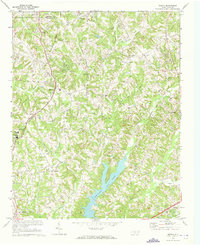
1969 Map of Midway
USGS Topo · Published 1973About this map
The border of Forsyth Co and Davidson Co defines the northern reaches of this map, where the rural character of central North Carolina meets the developing corridors of the 1960s. The Winston-Salem Southbound railroad cuts through the landscape, anchoring the settlement of Midway, which serves as a central hub for the surrounding community. Numerous country churches and cemeteries, such as Bethlehem Ch, Hebron Ch, and Saints Delite Ch, dot the hillsides, reflecting the long-established social fabric of the Piedmont.
Find a feature on this map
46 named features on this map. Tap any name to fly to it.
Don’t see what you’re looking for? This feature index may not catch every label — zoom into the map to look around manually.
Map Details
Editions of this 1969 Midway Map
4 editions found
Other maps of this area

1949 · Eller
USGS Topo · 1:24,000

1949 · High Point West
USGS Topo · 1:24,000

1950 · Winston-Salem West
USGS Topo · 1:24,000

1950 · Lexington East
USGS Topo · 1:24,000

1950 · Winston-Salem East
USGS Topo · 1:24,000

1950 · Lexington West
USGS Topo · 1:24,000

1951 · Winston-Salem West
USGS Topo · 1:24,000

1951 · Winston-Salem East
USGS Topo · 1:24,000

1951 · Lexington East
USGS Topo · 1:24,000

1951 · Lexington West
USGS Topo · 1:24,000