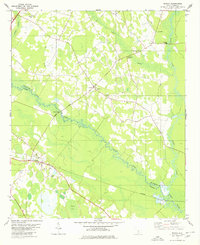
1979 Map of Midway
USGS Topo · Published 1980About this map
The South Fork Edisto River and North Fork Edisto River converge in this low-lying region of the South Carolina Coastal Plain, forming a landscape defined by extensive wetlands like Snake Swamp and Dry Swamp. The human imprint on this watery terrain is visible in the Isaac Jennings Canal and a network of crossings including the Rowesville Bridge and Cannon Bridge. Small agricultural communities and railway stops punctuate the landscape, notably Midway along the Southern railroad line.
Find a feature on this map
31 named features on this map. Tap any name to fly to it.
Don’t see what you’re looking for? This feature index may not catch every label — zoom into the map to look around manually.
Map Details
Editions of this 1979 Midway Map
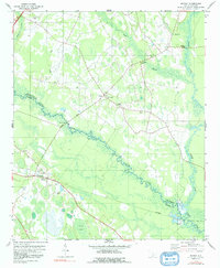
2 editions found
Other maps of this area

1919 · Olar
USGS Topo · 1:62,500

1919 · Bamberg
USGS Topo · 1:48,000

1919 · Lodge
USGS Topo · 1:62,500

1920 · Lodge
USGS Topo · 1:48,000

1920 · Bamberg
USGS Topo · 1:62,500

1920 · Orangeburg
USGS Topo · 1:48,000

1921 · Orangeburg
USGS Topo · 1:62,500

1921 · Lodge
USGS Topo · 1:62,500

1943 · Olar
USGS Topo · 1:62,500

1943 · Lodge
USGS Topo · 1:62,500