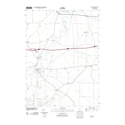
2010 Map of Milan
USGS Topo · Published 2010About this map
Milan serves as the focal point of this 2010 topographic study, situated where the Milan Post Office and Milan Cemetery anchor the local community. The landscape is defined by the Huron River valley and the prominent North Milan Hill, which overlooks the smaller settlements of North Milan and Avery. To the south and east, the map traces the intersection of historic local roads like Old State Rd N and Laylin Rd near East Norwalk, where the Saint Marys Cemetery and East Norwalk Cemetery provide significant points of interest for genealogical research. The northern section of the map reveals a shift toward recreation and transit, featuring the Thunderbird Golf Course and aviation landmarks such as Zorn Acres Airport and the Homestead Inn Landing Field. The integration of the Sandusky Norwalk Interchange 7 shows the modern transportation corridor cutting through traditional farm holdings like Schuster Farms.
Find a feature on this map
64 named features on this map. Tap any name to fly to it.
Don’t see what you’re looking for? This feature index may not catch every label — zoom into the map to look around manually.
Map Details
Editions of this 2010 Milan Map
This is the sole edition of this map. No revisions or reprints were ever made.
Other maps of this area

1903 · Vermilion
USGS Topo · 1:62,500

1904 · Sandusky
USGS Topo · 1:62,500

1908 · New London
USGS Topo · 1:62,500

1915 · Norwalk
USGS Topo · 1:62,500

1944 · Norwalk
USGS Topo · 1:62,500

1956 · Toledo
USGS Topo · 1:250,000

1959 · Kimball
USGS Topo · 1:24,000

1959 · Milan
USGS Topo · 1:24,000

1959 · Sandusky
USGS Topo · 1:24,000

1959 · Berlin Heights
USGS Topo · 1:24,000