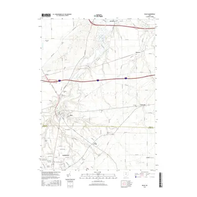
2016 Map of Milan
USGS Topo · Published 2016About this map
Norwalk and Milan anchor this 2016 survey of the north-central Ohio corridor, where the Huron River carves a winding path through the landscape toward Lake Erie. The map captures the intersection of traditional agricultural routes and modern transit, with the river's meandering oxbows contrasting against the straight lines of the interstate and US Rte 250. Small settlements like Avery, Shinrock, and Berlinville remain distinct markers of the region's historical community structure.
Find a feature on this map
98 named features on this map. Tap any name to fly to it.
Don’t see what you’re looking for? This feature index may not catch every label — zoom into the map to look around manually.
Map Details
Editions of this 2016 Milan Map
This is the sole edition of this map. No revisions or reprints were ever made.
Other maps of this area

1903 · Vermilion
USGS Topo · 1:62,500

1904 · Sandusky
USGS Topo · 1:62,500

1908 · New London
USGS Topo · 1:62,500

1915 · Norwalk
USGS Topo · 1:62,500

1944 · Norwalk
USGS Topo · 1:62,500

1956 · Toledo
USGS Topo · 1:250,000

1959 · Kimball
USGS Topo · 1:24,000

1959 · Milan
USGS Topo · 1:24,000

1959 · Sandusky
USGS Topo · 1:24,000

1959 · Berlin Heights
USGS Topo · 1:24,000