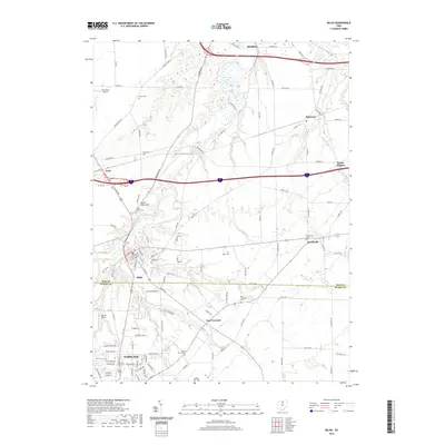
2019 Map of Milan
USGS Topo · Published 2019About this map
The Huron River winds through the northern reaches of this Huron County landscape, carving a valley that separates the historic village of Milan from the high ground of North Milan Hill. This area is marked by a deep concentration of nineteenth-century burial grounds, including the Milan Cem, O'Dell Cem, and Sweet Cem, which serve as vital touchstones for genealogical research in the Firelands region. To the south, the city of Norwalk shows its modern industrial and residential growth, with Industrial Pkwy and neighborhoods like East Norwalk anchoring the southern corridor. The map highlights the transition from the concentrated urban streets of Norwalk to the smaller outlying settlements of Berlinville, Avery, and Shinrock, all connected by a dense network of township roads and county highways that bridge the agricultural and industrial divide.
Find a feature on this map
108 named features on this map. Tap any name to fly to it.
Don’t see what you’re looking for? This feature index may not catch every label — zoom into the map to look around manually.
Map Details
Editions of this 2019 Milan Map
This is the sole edition of this map. No revisions or reprints were ever made.
Other maps of this area

1903 · Vermilion
USGS Topo · 1:62,500

1904 · Sandusky
USGS Topo · 1:62,500

1908 · New London
USGS Topo · 1:62,500

1915 · Norwalk
USGS Topo · 1:62,500

1944 · Norwalk
USGS Topo · 1:62,500

1956 · Toledo
USGS Topo · 1:250,000

1959 · Kimball
USGS Topo · 1:24,000

1959 · Milan
USGS Topo · 1:24,000

1959 · Sandusky
USGS Topo · 1:24,000

1959 · Berlin Heights
USGS Topo · 1:24,000