
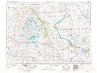
1953 Map of Milbank
USGS Topo · Published 1958About this map
The Sisseton Indian Reservation dominates the landscape of this mid-century survey, stretching across the lake-strewn glacial terrain of the Coteau des Prairies. This region at the borders of South Dakota, North Dakota, and Minnesota is defined by a complex hydraulic system, where the continental divide separates waters flowing toward the Hudson Bay via the Bois de Sioux River from those heading toward the Gulf of Mexico through the Minnesota River. Large glacial lakes like Lake Traverse and Big Stone Lake form the natural boundary between states, while inland, smaller bodies such as Enemy Swim Lake and Waubay Lake are protected within the Waubay National Wildlife Refuge.
Find a feature on this map
163 named features on this map. Tap any name to fly to it.
Don’t see what you’re looking for? This feature index may not catch every label — zoom into the map to look around manually.
Map Details
Editions of this 1953 Milbank Map
3 editions found
Other maps of this area

1894 · Conde
USGS Topo · 1:62,500

1894 · Hecla
USGS Topo · 1:62,500

1894 · Oakes
USGS Topo · 1:62,500

1895 · Byron
USGS Topo · 1:125,000

1895 · Lamoure
USGS Topo · 1:125,000

1895 · Aberdeen
USGS Topo · 1:125,000

1896 · Columbia
USGS Topo · 1:125,000

1904 · Wahpeton
USGS Topo · 1:125,000

1907 · Wyndmere
USGS Topo · 1:125,000

1910 · Wendell
USGS Topo · 1:62,500