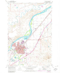
1968 Map of Miles City
USGS Topo · Published 1980About this map
Miles City sits at the confluence of the Yellowstone River and the Tongue River, serving as a vital Montana rail and agricultural hub. This 1968 survey, updated with 1978 photogrammetric data, reveals the detailed street grid from Truscott St to Sudlow St, along with the industrial and social infrastructure of the mid-20th century. The presence of the Chicago Milwaukee St Paul and Pacific and Burlington Northern railroads underscores the city's role in the regional transport network, while the Miles City Municipal Airport signals its modern expansion.
Find a feature on this map
54 named features on this map. Tap any name to fly to it.
Don’t see what you’re looking for? This feature index may not catch every label — zoom into the map to look around manually.
Map Details
Editions of this 1968 Miles City Map
2 editions found
Other maps of this area

1953 · Miles City
USGS Topo · 1:250,000

1957 · Miles City
USGS Topo · 1:250,000

1958 · Miles City
USGS Topo · 1:250,000

1968 · Big Hill
USGS Topo · 1:24,000

1968 · Miles City
USGS Topo · 1:24,000

1968 · Lignite Creek
USGS Topo · 1:24,000

1968 · Paddy Fay Creek
USGS Topo · 1:24,000

1969 · Noble Reservoir
USGS Topo · 1:24,000
1969 · Deadman Creek
USGS Topo · 1:24,000

1969 · Kinsey
USGS Topo · 1:24,000
Featured Places
- Miles City, MT
- Smiths Trailer Court, Miles City
- Carbon Hill Trailer Court, Miles City
- Westwood Estates, Miles City
- Tusler, MT